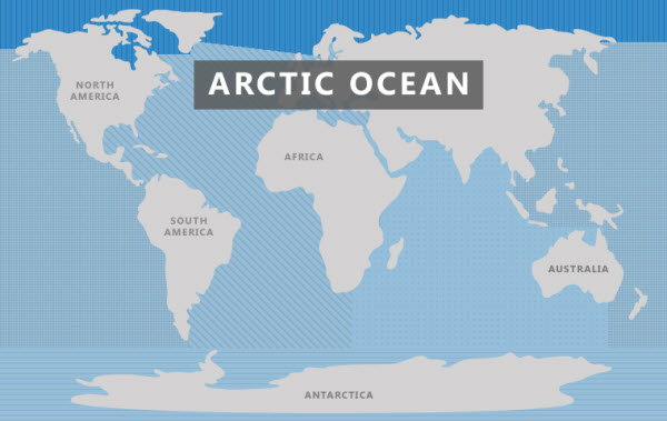
The Arctic Ocean is the fifth-largest oceanic division on Earth, following the Pacific, Atlantic, Indian, and Southern Oceans. It is the shallowest and coldest of them all, covering a total area of about 14 million square kilometers. Some view it as the northernmost part of the global ocean system or an extension of the Atlantic Ocean. It spans from the Arctic region in the north to about 60 degrees north latitude and is bordered by the continents of Eurasia and North America. The Bering Strait separates it from the Pacific Ocean, while Greenland lies between it and the Atlantic Ocean.
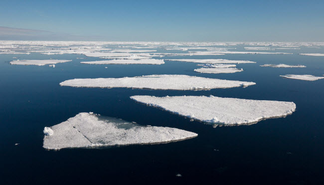
One unique characteristic of the Arctic Ocean is that it is covered by sea ice throughout the year, with ice extent and salinity levels that are the lowest among all the oceans. This ocean experiences significant seasonal variations in temperature and salinity, influenced by the influx of freshwater from rivers, ice melt, and precipitation.
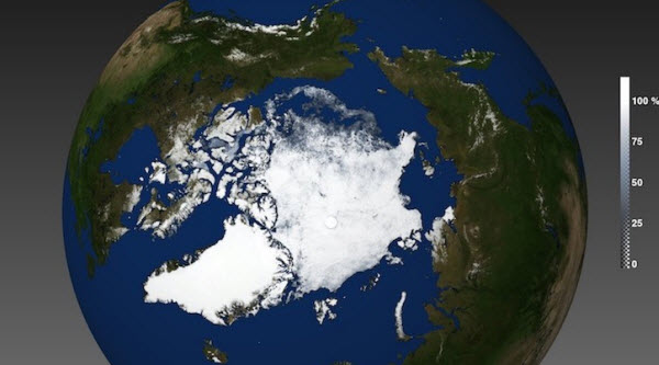
The Arctic Ocean is one of the most closely monitored bodies of water, with organizations such as the U.S. National Snow and Ice Data Center using satellite data to provide daily updates on ice coverage and melting rates. Recent reports have shown a consistent decrease in sea ice, with record lows observed in September 2012 when sea ice extent shrank by 49%, largely due to global warming and the presence of pollutants, including radioactive contaminants.
Historical Exploration of the Arctic Ocean
Historically, the Arctic region was largely unexplored by Europeans. The geography of this area remained speculative until the Greek geographer Pytheas recorded a voyage northward around 325 BCE to a land he called “Ultima Thule,” where he described a place where the sun set for only three hours each day and where the water turned into a frozen substance that could not be walked on, likely referring to slushy sea ice. Historians suggest that “Thule” might have been Norway, although other locations like the Faroe Islands or Shetland have also been proposed.
Early cartographers were unsure whether to depict the Arctic region as land or sea. European traders, motivated by the desire for a northern passage to China, necessitated the exploration of this area, resulting in maps depicting it as a water-filled region. The few expeditions beyond the Arctic Circle during this era added only a few small islands to the maps.
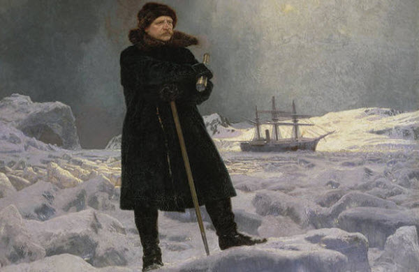
In the 19th century, the unknown north of the ice barrier led to various speculations, including the myth of an “open polar sea,” which persisted until British admiralty secretary John Barrow’s explorations from 1818 to 1845. All explorers traveling near the pole reported encountering thick ice coverage year-round until Fridtjof Nansen made the first recorded maritime crossing of the Arctic Ocean in 1896.
During the 20th century, the Arctic Ocean’s European area became a battleground during World War II, witnessing skirmishes between German naval and air forces and Allied forces supplying the Soviet Union via its northern ports. In 1969, Wally Herbert led the first overland crossing of the ocean on an expedition using sleds pulled by dogs from Alaska, USA, to Svalbard, Norway. By 1954, commercial airlines began flying over the Arctic Ocean, and in 1958, the submarine Nautilus made the first submarine transit of the North Pole. The first surface crossing by an icebreaker occurred in 1977.
Geography of the Arctic Ocean
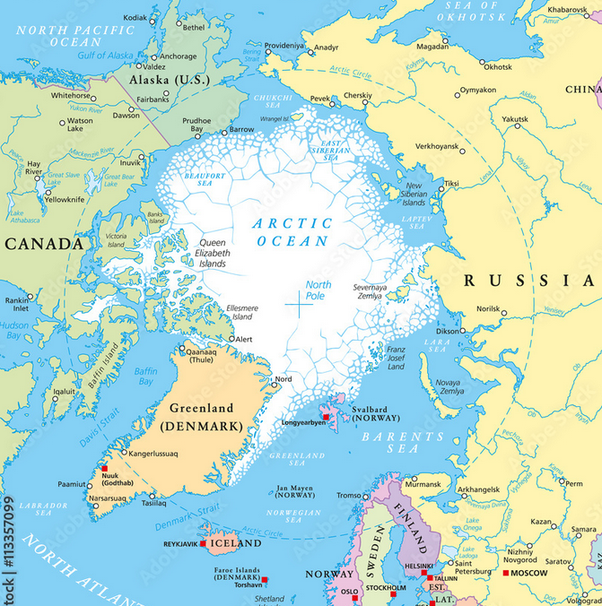
The Arctic Ocean occupies a nearly circular basin and covers an area of about 14 million square kilometers, roughly the size of Antarctica. It is the only ocean smaller than Russia and is surrounded by the landmasses of Eurasia (Russia and Norway), North America (Canada and Alaska), Greenland, and Iceland.
The Arctic Ocean is connected to the Pacific Ocean via the Bering Strait and to the Atlantic Ocean through the Greenland Sea and Labrador Sea. It also includes several marginal seas and bays, such as the Barents Sea, Hudson Bay, Greenland Sea, East Siberian Sea, Kara Sea, Laptev Sea, Chukchi Sea, Beaufort Sea, Amundsen Gulf, White Sea, Pechora Sea, Lincoln Sea, Prince Gustav Adolf Sea, Queen Victoria Sea, Wandel Sea, and various islands and archipelagos like Jan Mayen (Norway), Iceland, Greenland, the Canadian Arctic Archipelago (including the Queen Elizabeth Islands and Baffin Island), Wrangel Island (Russia), the New Siberian Islands (Russia), Severnaya Zemlya (Russia), Novaya Zemlya (Russia, including Severny and Yuzhny Islands), Franz Josef Land (Russia), and Svalbard (Norway, including Bear Island).
Geology of the Arctic Ocean
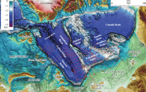
The Arctic Ocean’s continental shelf comprises several shelves, including the Canadian shelf beneath the Canadian Arctic Archipelago and the Russian shelf, sometimes called the “Arctic Shelf” due to its extensive range, consisting of the Barents Shelf, Chukchi Shelf, and the Siberian Shelf, which is the largest of its kind in the world and holds significant oil and gas reserves. The Chukchi Shelf marks the boundary between Russia and the United States as defined in the maritime boundary agreement between the Soviet Union and the United States.
Beneath the Arctic Ocean lies a series of underwater ridges that divide its depths into two major ocean basins: the Eurasian Basin, with depths ranging from 4,000 to 4,500 meters, and the Amerasian Basin, which is about 4,000 meters deep. The ocean floor features faulted block ridges and abyssal plains, with an average depth of 1,038 meters. The deepest point, Molloy Hole in the Fram Strait, reaches down to 5,550 meters.
Characteristics of the Arctic Ocean
Salinity
The surface waters of the Arctic Ocean, extending to depths of about 200 meters, are the most variable due to the latent heat flux that governs freezing and melting. Freshwater inputs from rivers, melting ice, precipitation, significant differences in solar radiation (insolation), and energy exchange due to sea ice cover all contribute to the variability in salinity, which ranges from 28 to 34 parts per thousand, making it the least saline of all oceans.
Climate
The Arctic Ocean is located in a polar climate zone characterized by persistent cold. Winters feature polar nights and extreme cold, while summers are marked by continuous daylight (midnight sun), with air temperatures occasionally rising slightly above 0 degrees Celsius. Cyclones are more frequent in the summer, potentially bringing rain or snow. The region remains cloudy throughout the year, and the surface water temperature of the Arctic Ocean is relatively stable, hovering around −1.8 degrees Celsius, near the freezing point of seawater.
Economic Importance of the Arctic Ocean
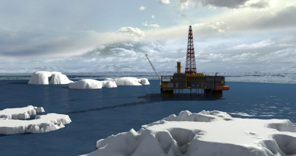
The Arctic Ocean is rich in natural resources, including oil, natural gas, minerals, sand, and gravel, which are extracted by bordering countries for economic benefit. The ocean also harbors various fish species and marine life, such as seals and whales.
Due to its wealth of resources, the Arctic Ocean is a point of contention among the United States, Russia, Canada, Norway, and Denmark. It is considered critical to the energy market because it may contain 25% or more of the world’s undiscovered oil and gas resources.
Threats to the Arctic Ocean
Global warming is causing the Arctic Ocean to become ice-free in summer for the first time in human history, potentially by 2040. Rising temperatures in the Arctic could lead to large amounts of meltwater entering the North Atlantic, disrupting global ocean current patterns and causing significant changes in Earth’s climate.
Additionally, global warming has led to increased encounters between polar bears and humans as shrinking sea ice forces bears to search for new food sources. This problem peaked in February 2019 when a mass invasion of polar bears in the Novaya Zemlya archipelago prompted local authorities to declare a state of emergency after dozens of bears were seen entering homes, public buildings, and populated areas.
Other environmental concerns in the Arctic Ocean include radioactive pollution from Russian radioactive waste dumping sites in the Kara Sea, nuclear testing sites from the Cold War era such as Novaya Zemlya, and contaminants from the “Camp Century” project in Greenland.
